Hiking the Laugavegur Trail: Iceland's Most Spectacular Multi-Day Trek
Everything you need to plan and complete Iceland's legendary 55km Laugavegur Trail — from hut bookings and gear lists to the most breathtaking viewpoints and what to do when the weather turns savage.
Hiking the Laugavegur Trail: Iceland’s Most Spectacular Multi-Day Trek
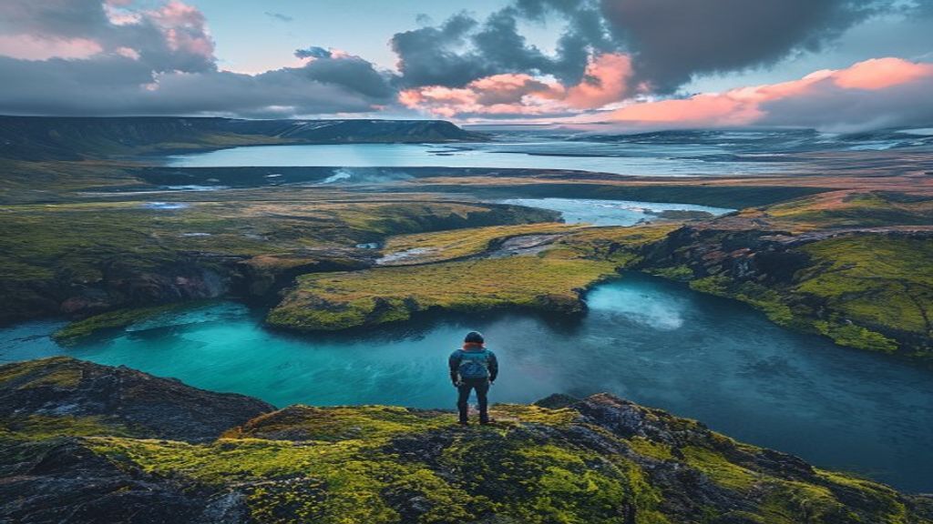
Few trails on Earth deliver such relentless, jaw-dropping scenery for every single kilometer. The Laugavegur Trail stretches 55km (34 miles) across Iceland’s volcanic interior, connecting the geothermal wonderland of Landmannalaugar in the north to the lush, waterfall-draped valley of Þórsmörk in the south. You’ll cross obsidian lava fields, neon-green valleys, black sand deserts, glacial rivers, and snowfields — sometimes all in the same afternoon.
This guide tells you exactly how to do it right.
📅 When to Go
The trail is only reliably open late June through early September. July and August are peak season — warmer (8–14°C / 46–57°F), more daylight (Iceland barely gets dark in summer), and huts fully staffed, but also crowded.
Our recommendation: late August or early September. The highland colors shift to rust, gold, and burgundy as autumn creeps in. Crowds thin noticeably. The light is softer and more dramatic for photography. Nights are crisp but still manageable.
What to Avoid: Never attempt the trail before the official opening date (usually mid-June). River crossings can be dangerously swollen with snowmelt, and trail conditions change rapidly. Check safetravel.is and fi.is (Ferðafélag Íslands) before every stage.
🗓️ The 4-Day Itinerary
Day 1 — Landmannalaugar to Hrafntinnusker (12km) This is the hardest day, gaining ~500m in elevation. But it’s immediately spectacular: you’ll walk through bubbling sulfur fumaroles, across rainbow-colored rhyolite mountains streaked in pink, green, and yellow. The Hrafntinnusker hut sits at 1,100m — it can snow here even in August. Soak your legs in the natural hot spring at Landmannalaugar before you leave.
Insider Tip: The hot spring at the Landmannalaugar base camp is free and open to all hikers. Go at dusk the night before you set off — it’s practically sacred.
Day 2 — Hrafntinnusker to Álftavatn (12km) The trail descends from the highlands into gentler terrain, passing the stunning Jökultungur ridge with panoramic views of multiple glaciers. The Álftavatn lake hut is one of the most scenic camping spots in Iceland — turquoise glacial water with Mýrdalsjökull glacier looming behind it.
Day 3 — Álftavatn to Emstrur/Botnar (15km) Today you cross the black sand desert of Mælifellssandur — a Mars-like expanse of volcanic ash and gravel. The vivid green cone of Mælifell volcano rising from the dark sand is one of the trail’s iconic images. Cross the glacial meltwater rivers carefully; poles are essential.
River Crossing Alert: The Bláfjallakvísl and Þröngá rivers require wading. They’re typically knee-deep in late summer but can rise fast after rain. Unclip your pack’s hip belt before crossing so you can shed it if you fall.
Day 4 — Emstrur to Þórsmörk (16km) The grand finale drops you into the Þórsmörk valley — a lush, protected hollow surrounded by three glaciers, dense birch woodland, and roaring waterfalls. Finish at the Volcano Huts or Húsadalur huts and celebrate with a hot meal and a cold Icelandic beer.
🏠 Huts vs. Camping
The trail is serviced by Ferðafélag Íslands (FI) mountain huts, which must be booked months in advance (booking opens in January each year at fi.is). Huts include sleeping bag space, cooking facilities, and warming rooms.
| Option | Cost (per night, approx.) |
|---|---|
| Hut sleeping bag space | ISK 8,000–12,000 (~$55–$85 USD) |
| Hut + sleeping bag rental | ISK 11,000–15,000 (~$75–$105 USD) |
| Camping at hut sites | ISK 3,000–4,500 (~$20–$32 USD) |
Book huts the moment registration opens in January. They sell out within days. If you miss hut slots, camping is allowed at all hut sites — bring a 4-season tent, it can and does snow.
🎒 Essential Gear
- Waterproof everything: jacket, trousers, pack cover. Weather changes in under 30 minutes.
- Trekking poles: non-negotiable for river crossings and steep descents.
- Gaiters: the black sand and volcanic grit will get into everything.
- Microspikes: useful early season when snowfields persist near Hrafntinnusker.
- Layers, not just warm: you’ll be too hot on clear ascents and freezing on windy ridges within the same hour.
- Water filter or purification tablets: streams are generally clean but glacial silt can irritate.
🚌 Getting There & Away
- To Landmannalaugar: Reykjavík Excursions and Trex both run scheduled highland buses from Reykjavík (BSÍ Bus Terminal) from late June. Book at re.is or trex.is. Journey: ~4 hours, ~$70–$90 USD one-way.
- From Þórsmörk: Buses return to Reykjavík, or continue on the Fimmvörðuháls Trail to Skógar for an extended 6–7 day adventure.
- No private cars can reach either trailhead without a serious 4WD — leave the rental in Reykjavík.
💰 Total Budget Estimate (4 Days)
| Item | Estimated Cost |
|---|---|
| Bus to/from trailheads | $140–$180 USD |
| Hut accommodation (4 nights) | $220–$340 USD |
| Food (self-catered, packed) | $60–$90 USD |
| Total | ~$420–$610 USD |
🧠 Final Insider Tips
- Pack out everything. Leave No Trace is taken seriously in Iceland — rangers patrol the trail.
- Download maps.me or purchase the Laugavegur Gps trail map offline — cell coverage is zero in the highlands.
- The aurora borealis is possible in late August/September if skies clear at night. Sleep near a hut window.
- Don’t rush Day 2’s ridge descent at Jökultungur. Sit. Stare. Let it become part of you.
The Laugavegur doesn’t just show you Iceland — it makes you feel it beneath your boots, in the sulfurous wind, and in the volcanic silence between ridgelines. Plan carefully, pack wisely, and it will be one of the great experiences of your life.